Sunday, March 27, 2011

March 27th - FROM KINGMAN, AZ TO .....OUTERSPACE!

Route 93 from Kingman, Az to our camping site  on Signal Road

Joshua Tree on Hwy 93 - Arizona

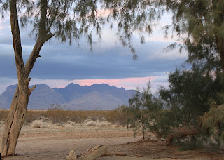
Signal Road Boondocking - mountain covered with Quartz

A walk up Signal Road about 2 miles from camper

Ocotillo cactus in bloom on Signal Road


Natural Quartz rock vase for desert flower
Winding Hwy 60 from Globe to Show Low, Az

Garmin GPS diagram of Hwy 60 contortions 

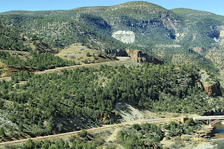
Salt River Canyon on Hwy 60

Campsite in Fool Hollow Recreation Area, Show Low, Az


My New Best Friend in Pie Town, New Mexico - I got my dog fix and he got popcorn!


VLA  (Very Large Array)  50 miles west of Socorro, New Mexico - This is only a very very small section of the whole array.


The journey continues.   After leaving Kingman, Az  we continued our trek through the southwest going to a spot we had discovered last year.  I have mentioned boondocking or dry camping many times in my blog, but as a refresher it is camping in an area of public domain such as a National Forest, BLM (Bureau of Land Mangement Land) that is truly OUR land.  Our taxes pay for this land that has been set aside for camping, and recreation.  This area that we traveled to after leaving Kingman, Az in just off Hwy. 93 south east of Kingman.  Unfortunately we were unable to get into the place we had marked last year as "Quartz Mountain".  It was just too narrow and too difficult to get a 30 foot motor home into, and more importantly -out of.   We reluctantly turned around ( 8 point turn around I might add) and went back down the road to our spot from last year.  We hiked, picked pretty rocks and soaked up the beauty  and quiet that is the desert.  Our last day there it rained and we actually watched the desert floor turn to a carpet of green velvet. After it rains in the desert the air becomes so crystal clear and it seems you can see forever.

We continued south  through Phoenix to an area  outside of Globe, Az in an Indian Reservation Casino RV park for a couple of nights to catch up on the internet, laundry (me) and bread making (Richard) and also for me to get psyched - up for the journey the next morning through the mountains to Show Low, Az.  It seems I have developed  a bit of a phobia for roads that combine  elevation, sharp switch back type curves in the road and thousand foot drop offs with no shoulders!  I did ok!!!  I was even able to take some pictures while the vehicle was  moving as I stayed in the passenger seat instead of sitting on the floor in the back of the camper with my eyes shut!

It was as close to the Grand Canyon as you can get in take-your-breath-away beauty.    This highway led us to Show Low, Az which is much cooler because of the high altitude of about 6300 feet.  This is a favorite vacationing location for people  from Arizona and New Mexico to come to in the  summer as it is around 20 degrees cooler then in the lower elevations of their respective states.     We stayed in the Fool Hollow Recreation Area and the nights did get down to a low enough temperture for our furnace to kick on.   (About 30 degrees); however, the days were clear and mild and great for hiking or biking.

Yesterday we found a little (and I do mean little) RV park in Pie Town, New Mexico east of Show Low, Az.  . It boasted 5 spaces for RV's with water, electric and sewer and......WiFi!! The village is known primarily for Elk Hunting, cattle ranches and......pie!  There isn't much else to Pie Town than cafes that make and sell pies.  I was fortunate in going into one of the little cafes just when a fresh strawberry custard was finished.  The custard was still warm and it was.....awesome!!!  The presentation of the pie was so pretty.   I should have taken a picture of it but I was too much in a hurry to eat it!!

Today we traveled from Pie Town, NM to Socorro, NM about 75 miles south of Albuquerque, stopping on the way for me to pick rocks and to visit the VLA.  You all will probably remember the movie Contact with Jodie  Foster?  Well, this is where a lot of the filming was done.  As we were driving by and looking at all the huge strange shaped satellite like dishes,  I mentioned to Richard that all of this area looked so familiar.  Then it hit me!  Contact!   The movie. There was a visitor's center with tours available; pamphlets, and yes,of course, T-shirts, etc.  It is extremely interesting and if possible you should Google and research this facility.  VLA stands for Very Large  Array.  Yup, doesn't sound like they worked too hard coming up with a name for the what this place really is but there you have it.  VLA.   Truly it is extremely interesting.  In a very short capsule:  The VLA consists of 27 antennas, each measuring 81 feet in diameter and weighing approximately 200 tons.  The VLA receives the naturally occurring radio waves from planets, stars, and galaxies throughout the Universe.  This whole "array" can be rearranged into four different shapes depending on what area of space they are "listening to".  PHD students in Astronomy can apply to have access to the facility for their research.   This particular site is located on the Plains of San Augustin, 50 miles west of Socorro, New Mexico.

This is where we find ourselves tonight - Socorro, New Mexico.  We turn north to Albuquerque tomorrow to get set for the 2011 Iron County Cancer Survivor's bike ride to begin on March 29th!

Wednesday, March 16, 2011

March 16th INSTANT GRATIFICATION

Rock formations around Kingman, Arizona
Overlooking park of New Kingman

High atop the mountain between Old and New Kingman (on bike ride) This is New Kingman

Rock "People" surrounding Kingman

A brief respite before another climb between the two Kingmans


Many are  preparing for St. Patrick's Day tomorrow - thinking green;  green beer, green frosting on cupcakes, green clothing, green hats, and green hair. Many people will participate in parades to celebrate the day regardless of their individual ethnicity; a reason to have a party.......to celebrate life.

My thoughts are far from celebratory on the eve of St Paddy's Day. I am frustrated! The source of my frustration is tecnology - specifically - cell phones and the ability to be connected to the blasted things, especially the internet.

Over two years ago I had a major melt down with At&T.   For the sake of brevity and my sanity, I will not go into the crazy details of the cause of my melt down. I don't think the Blogger site would allow the space it would take to tell my story of the AT& T debacle of trying to get a connection to the internet. I have let that go (not really) and have been extremely pleased with the Broadband 760 device from Verizon that I joyfully replaced the AT&T non - connection with. Until......yesterday. . Suddenly in Kingman, Az Verizon disappeared from the Broadband scene and I was no longer able to get connected to the internet. My cell phone is fine - no problem with signal strength at all but the "stick" for the computer simply gave me an error message with a number on it. I called Verizon and they tried to walk me through the problem with a fix. A band aid at best. A couple of hours later the same problem popped up. Another call to Verizon and a no go. I was informed that the device must be "defective" and, joy of joys I was due for an Upgrade on this defective device!! They convinced me to order the relatively new MiFi card, a device that will allow up to 5 computers to ride in on the signal from this new card. Sounded great and they would overnight it to me via FedEx.  It arrived this morning as promised. I immediately called Verizon to get my new little tecnological wonder hooked up and activated. After 30 minutes of trying everything under the sun, the representative asked where we were physically located at the present time. When informed that we were in Kingman, Arizona she stated that we couldn't activate in Kingman. We would have to drive to Phoenix to activate. It appears that this area is one of the very very few "dead" zones for Verizon. The device, and I will quote " needs to be in a direct line of the Verizon towers" to be activated. "Once activated, you  will be able to connect almost anywhere in the contiguous United States". (Amen)

I took a deep breath, said a couple of bad words under my breath, thanked the very nice Verizon representative who had tried everything to get the device activated. Both Richard and I decided a long hard bike ride was in order.

I realized (after the long hard bike ride) that we have become so dependant on the available tecnology which is out there now. We have come to expect to be connected to the rest of world with a touch of a key on a computer. What happened to post cards, letters, not to mention phone calls., or the simple communication by the spoken word with those around us. What will occur if we lose all the high tech, high speed tecnology?

The tragedy in Japan brings all this into crystal clear focus. All the above is nothing. Absolutely nothing. What is important in life is the ability to connect with the people around us in whatever manner is natural. Water, food, shelter, safety is what is important, not the high tech tecnology that we have come to depend on - like texting on cell phones; computers and.......nuclear power plants. Our attention has been diverted; we have allowed it to be diverted to anything and everything that is faster, easier, convenient...instant gratification.

Sunday, March 13, 2011

March 13th - THE PULL OF THE DESERT

Road down into the Lake Mead Recreational Area
Overlooking campsite
We have company - wild Burros
Part of the small group
A couple of Jennies and a young one
Two outcast young males learning how to play fight

"Do you guys have carrots...oats...sugar?"
Two of four wild horses
I spooked them and they ran
The lone stallion on guard (mares hidden)
Evening at the reservoir (Lake Mead)
Another cairn built by Jackie
Long winding road back out

A few days ago we got our fill of civilization (water, dump station and the ever desired internet signal) and headed back out into the desert.  We had camped on the Nevada side of the Colorado River (Lake Mead) last winter and wanted to see if the Arizona side would be the same in amount of water, dried areas, etc.  We discovered that much of the mapped areas for camping and fishing are similiar to the Nevada stretch - no water, no camping. When I say no water, I mean the reservoir has dried up to leave vast stretches of land that was once flooded by the Hoover or Boulder Dam -  no longer with water. This area, however, still allows dry camping or boondocking as we call it.  No facilities other then a gate area with a very governmental looking cement building but it has been abandoned and no park rangers on site  or in sight to collect the minimal fee that is required for camping.  I might add that the boat marina is high and dry as well.

We drove on the dirt, two- track washboard road  for about 6 miles before coming to the water.  We found a spot, got as level as possible and set up camp.  Not five minutes after arriving, we saw a small band  of wild burros about 100 yards away  getting ready to go down to the water for a drink.  We saw them continually throughout our three night stay.  One afternoon, I had the feeling that someone was watching the camper.  I looked up and out the window and there not 10 feet away stood the two young males of the herd who have been kicked out by the dominant male (Jack) of the group.  Those two were constantly play fighting with each other.  They appeared to be showing off for us.  We threw some carrots out but they didn't seem interested at the time. 

I went out for a walk the first afternoon we were camped and as I rounded a curve in the winding dirt road I looked up and saw the large body of a horse in the brush at the side of the road.  I didn't have my camera so I quickly went back to the camper to grab the camera and get back to the horses.  There were four of them - one stallion and at least two mares with one young foal in the group.  When they caught wind of me, the stallion ran a few paces toward me and stopped.  A bluff charge (thank goodness)  A wild stallion can be extremely dangerous especially if he thinks you may be a threat to his little band of mares.  I made a noise and that spooked all of them and they ran up an embankment.  We saw them only from a distance over the next couple of days. 

It is so exciting to be out in the vast desert with no one but the animals.  It becomes addicting to be able to be on the land; watch it come alive with greenery and wild flowers in the spring.  It was icing on the cake to see all the wildlife. 

Monday, March 7, 2011

March 7th Desert Storms


Joshua Tree in Mohave Preserve

Kelso Dunes boondocking site

Clouds coming over the dunes
Ever changing dunes
Beginning of sunset
Our campsite in the dunes
Sunset and wind

Beyond words

The sun sets over the dunes

Clouds through the trees

Leaving Kelso Dunes in sand storm
Wind and sand continue to blow
Mountains hidden by blowing sand
Old Route 66 sand storm
(Click on this picture to make it bigger)  SEARCHER  ( spelled out in rocks)- that's me! On old Rt. 66


After coming back to civilization for a brief respite,  we headed back into the wilds of the Mohave National Preserve south of Death Valley.  This desolate desert at first seemed like, well.... Death Valley-lite after the extreme beauty we just departed a couple of days ago.  The decision was to dry camp in one of their few spots for boondocking.  Our choice for the night was the Kelso Sand Dunes.  These dunes are close to 700 feet in height and spread out over a 45 square mile area.  When we stopped yesterday afternoon the wind was picking up to about 25 MPH.  We were somewhat protected near a couple of trees that must have come up from an underground spring in the area.  When we arrived there was one other camper in the area but as the wind picked up they left; we were left alone for the night.  As dusk surrounded us,  the wind died down a bit so I was able to go out and take advantage of the beautiful clouds and sunset for pictures.  However, this morning the wind came on even more strongly and while looking  east where we should have been able to see mountains all that was visible was a huge wall of blowng sand. I have heard of sand storms, and we all have seen Lawrence of Arabia, but seeing the sand blowing  on the movie screen is NOTHING like being IN the real thing as we were driving out of the Kelso Dunes camp site!  I had visions of being "sanded"  instead of "snowed-in" the park. 

50 MPH  blistering winds continued to blow hard all day as we traveled out of the Preserve. The wind and sand stayed with us through the day.  The only benefit was it became a tail wind as we turned East and traveled along  Rt. 66 . We  were blown into an RV park in Needles, Ca.  Electric, water, laundry, and  yes the wind persists;  but most importantly we have......an internet signal.

Saturday, March 5, 2011

March 5th - Another World (Death Valley)


Angry sky south of Vegas
Boondocking spot south of Las Vegas

Lake Mead (Colorado River) near boondocking site
Skirting East of Las Vegas
Everything in California is expensive!

Heading toward Death Valley

I call this Neopolitan Ice cream (Death Valley)

Pistaschio Ice Cream

Looks like a mirage but is one of the salt flats in Death Valley

First night campsite (Texas Springs)

Cottonwood Tree near Mesquite Springs campsite

Nearing Bad Water Basin

Bad Water Basin - Sodium Chloride, Gypsum, Calcite and Borax

Spring flowers at lower elevation in Death Valley

The winding ribbon of road through the park

Hmmmmm.  Where did we put the camper?


I just realized a few hours ago that I might have a problem addiction --- to my phone and the internet.  As we were winding our way out of Death Valley - literally - I was beginning to go into withdrawal.  I had had no phone or internet signal for three days and as we came into view of a village outside of Death Valley I heard my phone beep!  It had gone into hibernation or power saver mode all by itself (isn't technology great)? and out of the back of the camper I heard a mournful "beep".  It was my phone coming back to life as it had picked up a signal from Heaven knows where.  I grabbed it up and hungrily checked my messages.  I had two!!  I immediately called the one person back who had left a message asking if I might be on another planet or universe.  Yes, and yes.!  Death Valley is truly another world.  The geology of the park is so diverse and it is a far cry from what we in the Midwest are familiar with.  Mountains and hills the color of Neapolitan Ice cream - yes, Neapolitan - Strawberry, Vanilla and Chocolate and further into the park comes Oreo Cream and Mocha and even further is Mint Chocolate Chip.  I am not kidding!!  Some of the formations resemble huge bowls of ice cream,  Then to interrupt the theme of desserts---- Mustard hills are (excuse the pun)  sandwiched in.  Food and humor aside, it is awe inspiring and coupled with 86 degree weather during the day with 29 % humidity it is easy to take.  We did do a couple of bike rides and it is easy to forget to drink water.  It doesn't subjectively feel hot, and we didn't really sweat, but riding up a two mile hill and not perspiring is a clue to how truly dry it is in Death Valley.

We spent two nights and three days camping in their dry camping areas.  No water or electric is available in any of their sites.  There is a bathroom with running cold water and an outside sink for campers who are tenting and there were several tents in all the sites we visited.  We traveled  as many  of the paved roads that were accessible to a camper the size of ours.  There are many  off road areas for 4 x 4 vehicles too, however, we found that several of those  were still closed because of snow and ice  in the higher elevations.

Elevation:  We were at the lowest 319 feet below sea level and at the highest about 3500 feet in the mountains.  The lowest area is titled  Bad Water Basin.  It was named this because the mule drivers for the Borax mining Company discovered their mules would not drink the water in the "lake".  Hence - Bad Water.  The salt basin covers many acres and is several miles long.  The dominant salt is Sodium Chloride with 3 other salts like Gypsum, Calcite and Borax

Tonight we are soaking up the comforts of technology - namely - communication via the internet.   It does make one ponder what we have allowed ourselves to become addicted to in this age of communication technology.

We are headed down to route 66 where it intersects Amboy, California and then we will head east once again to continue our travels back into Arizona and New Mexico until it is time for the Iron County Cancer fund drive and Richard's bike ride at the end of March which will depart out of Albuquerque.