Sunday, December 23, 2012

WE HAVE ARRIVED!


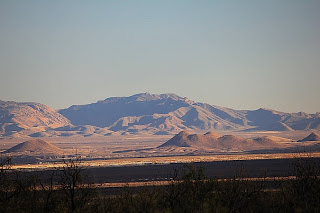
We have arrived!  Where?  West of Yuma, AZ into the California desert just east of the Imperial Dunes in an area where we camped last winter.  The site is technically Bureau of Land Management Land (BLM) for short.  Anyone can camp here for up to 14 days.  Pack it in, pack it out.  The attractions for me are the huge washes which are dry at present but can be filled with several feet of water in a downpour.  When dry they are wonderful sources of rocks for the rock hound.  Also surrounding these washes are small mountains to hike and explore.  This year we have the pleasure of company from Iron County.  Friends of Richard's who are full time RV'ers; meaning they live in their RV during the summer months in Iron County as well as travel throughout the winter in the southwest.   They are here and guided us in to their campsite.  It will be good to share Christmas with fellow Yoopers!
We began our sojourn on Nov. 17th heading to the lower peninsula of Michigan to our respective children's homes for Thanksgiving.  We headed south into Alabama so Richard could visit with his cousin. We were able to set up the motorhome for living by the time we reached Vicksburg, Mississippi.  We continued south to the Gulf and turned our nose west into Louisiana, through Texas and New Mexico and finally into Arizona.  We just crossed into California yesterday and into the desert.  It is warm, sunny and best of all we can share Christmas with others from home.
                                         Western Willet Galveston State Park                      
                                                              
                                               
                                    Ultimate high water proof handicap accessible home!

                                Yes..we had to go UP and OVER this bridge near Galveston.

                                Texas speed limit on two lane "highway"

                                    Just outside of Sanderson, Texas
                                            
                                         Mountain of soldiers - Saguaro Cactus

                                       California desert campsite

                                First desert campfire of the winter

                                           Lonely desert train

                               Sunset through the Ocotilla cactus and Palo Verde trees

                                Peace and & serene beauty of a desert sunset

MERRY CHRISTMAS  and A HAPPY HEALTHY NEW YEAR TO ALL!!                                                              
                                                                                                                                                                                                    

Wednesday, April 11, 2012

The Spring Migration

Grand Canyon Caverns Full Moon April 5th


Boondocking under the Rainbow in Ca

Beautiful Sunset California south of Needles

April 10th Boondocking near Salina, Ut

LDS Temple in Manti, Ut

Beginning the climb on Hwy 31

Almost at summit on Canyon road

Summit of Canyon Rd looking north 9800 feet high!


The birds are heading north for spring.  These two Snow Birds are no exception.  April 2nd we turned the nose of the motor-home north and started the long winding journey to the UP.  We decided this year to come home by a different route.  The last couple of years as we headed home we usually started out by turning east until we got into Texas and then turning north through Oklahoma, Kansas, Nebraska and so on.  This year the weather has allowed us to do a more northern route.  Less snow and warmer weather encouraged us to go up into Utah to see as much of the state as possible  and will then swing east through Colorado or Wyoming and onto Nebraska and then north once again.  It will depend on the snow, the mountains and how well I do the mountains!!!  Richard has the patience of Job but my hyperventilating and leaning way over to the left in my seat to not see the edge of the drop offs must drive him nuts!!! 

We entered Utah north of Flagstaff, AZ and wound into the Glen Canyon and Lake Powell (think reservoir) area.  We camped north of the dam right on the beach in an area called Lone Rock only about 20 feet from the water.  I even got my dog fix playing with other camper's dogs playing near and in the water.    Beautiful area.  From there we continued north along the route that took us into Bryce Canyon and Red Canyon.  I have seen very little of Utah but the areas I have seen are  very different.  It can be desert for 10 miles and suddenly there are mountains, red red rock and then huge ranching areas.  This is high desert area meaning the elevation is much higher then the lower desert near the Colorado River in Arizona.  We went from 107 feet to 7800 feet in two days!!! 

Today we left the main highway 89 north to cut east across on State Hwy 31 from Fairview, Ut to Hunington, Ut that took us across a mountain pass on a twisting turning road.  I do believe there may be holes in my seat cushion from my nails!  After much deep breathing I was able to relax and enjoy the view. 

This country of ours is so diverse in topography, geology, temperature and people.  We all are so fortunate to call the USA our land and even more so to call the UP home!!

On the lighter side....  We found another "Big Chicken"  Now we need a new drive in for Crystal Falls.  I think I could bungee him onto the roof of the motor-home!

The Big Chicken's big  brother!!!!
                                                        

I told him to go fly a kite......he did!  No....he isn't trying to fly, there are two strings on this trick kite. 
                                                         

Saturday, January 21, 2012

Jan 21st - American Girl Mine Boondocking

My Chocolate Ripple Mountain (Really American Girl Mine)
Looking south toward our camper from the summit of the mountain
Looking north near the summit of the mountain
Watching dune buggies travel east from atop the  mine
A view south of summit
Sand storm picking up after I left the mountain
15 min after sand storm started
Safely inside camper looking east during storm

                                                
We left Desert Paradise RV Park (certainly not what I would name it) and headed to the desert as soon  as we stocked up on necessary items such as food, water. We traveled west,  just across the Arizona border into California.  We knew there was Bureau of Land Management Land for camping up one of the roads heading north off Interstate 8 and we found it this year.  Last year we had a bit of difficulty and I do believe we blogged about it.  We still chuckle when we think of that episode in boondocking history.  (We were "relocated" by the Reservation Police)
Touche!!

We are in the American Girl Mine area near the old Ogilby Mine off Sidewinder Road.  This BLM land goes on for miles and miles and there are pretty well established dirt roads leading off into several directions across the desert.  We passed several campers spaced  together in "family" units and  others isolated from each other.  We drove within about 2 miles from what I hungrily  named Chocolate Ripple Mountain and parked the camper and set up house keeping.  There wasn't a another camper for at least a mile in any direction.  There are several washes with loads of fun rocks to pick up, check out and some to keep.  There is also a huge amount of quartz here in this area which means there may be gold in the surrounding mountains.  I researched the area and discovered that the Chocolate Ripple Mountain that I named is really the American Girl Mine and was mined for gold even up to the 1980's.  Richard road his bike up to the base of the mountain yesterday and walked to the top and I decided that I would walk it today. 

When I reached the mine shaft area I discovered 6 other people and dune buggies and other  off road vehicles parked at the mine entrance.   I said hello to them and asked if they might know what mineral had been mined at this location.  They all looked at each other and then shrugged their shoulders and commented "Ah..... don't know".  This made me think that they definitely did know but didn't want to "share" the information.   I certainly wasn't on a gold expedition, just curious and as always, looking for interesting rocks.    They also had wanted to summit the mountain on the narrow mine road that winds up to the top with one of their vehicles.  One of them did make it almost to the summit  but turned around (how I can't imagine) and made it safely back down.  After they took off into the desert I continued my trek to the summit.  Just as I reached the top a wind started picking up and as I looked off into the distance I realized that a dust or sand storm was in the making.  I quickly made my way down with high winds pushing me around on my way down the mountain.  I quickly walked  the 2 mile  distance back to the camper. As I reached the camper I saw that one of the bikes was missing and that Richard had gone for a  ride and was out in the sand storm also.  I gave him a call on the phone and he said "hold down the awning until I get there"! I discovered that the wind was about to rip off our awning and I struggled  to hold it down until he returned and  we managed to salvage the awning and our arms.  Sand storms come up quickly and pick up momentum in the desert and it feels like you are being sandpapered to a fine patina.  Your skin actually feels burned from the wind and sand.  Regardless, even a wild sand storm is beautiful  out here.  We will mark this as one of our favorite boondocking places. 

No sunset pictures tonight.  It was hidden from view by the sand and dust in the air.  We are still gritting it in our teeth too!!

Sunday, January 15, 2012

Organ Pipe Cactus National Monument


Start of Victoria Mine Trail hike
Palo Verde trees & Saguaro Cacti
Buddies for life Saguaros
Creosote plant bloom
Part of building of mine
Part of wall of mine
Looking out of mine building toward the east
Goodnight Organ Pipe Cactus


 A bit of trivia....Who knows the difference between a National Park and  a National Monument?  I just learned this myself at one of the outdoor programs that the park gives each night at 7:00PM in an outdoor amphitheater.  A National Park is created by an act of Congress.  A National Monument is created by a President.  Of course there are other differences; who administrates them etc but that was one little piece of trivia I learned at the presentation on Friday evening.
I really believe that Organ Pipe Cactus National Monument is one of our nation's best kept secrets. It seems less and less people are going there

This is our third visit to the Organ Pipe Cactus Monument.  Each year the weather has been different and we have run the gamut of hot to freezing to just about right this year.  This park's camping area is set up in such a way that there is natural habitat between each camp site.  There is no electric or sewer hook ups at this park but there is a dump station and a water fill area.  We added two solar panels this past summer which enables us to run just about everything inside the camper without ever having to turn on the generator to fill our bank of batteries.....even on a cloudy day.  The solar energy is wonderful. 

The reason I said that this park is a well kept secret is because out of the 150 sites I don't believe 10% were filled.  Some believe it is the park's proximity to the Mexican border and the warnings about drug smugglers.  We believe it may be a combination of that and the economy.  We did notice more tent campers and less really big Class A motor homes this year.  Those are the ones that get 4-6 miles per gallon of gas...if they are lucky and are not also towing an SUV.

This year the weather was very conducive to hiking and I took full advantage of the trails and the weather.  On Saturday I did a trail called the Victoria Mine Trail which is a 4.5 mile hike to an old gold, silver mine.  It is a somewhat strenuous hike with a lot of steep rocky grades but absolutely beautiful.  It is truly  another world.  It feels like a jungle all through the washes and  arroyos The whole area is so  filled with vegetation with  several types of cacti, Palo Verdi trees.  One feels so close to the earth hiking this trail.  The literature tells the camper to not hike alone but I took enough water, my walking stick that Richard made for me and took off.  It was great.  I only ran into two other people the whole time and that was back at the mine area when I was down on my hands and knees checking out Quartz rock when I looked up to see a young man and woman walking into the area.  I immediately felt guilty with the rock in my hand as it is clearly stated "Do not remove vegetation, minerals or other artifacts from the land".  I gently dropped my prize, smiled and said hello!

This part of the Sonoran desert is not quite at the blooming stage yet.  That will come at the end of February and beginning of March.  The first year we visited here we were fortunate to see the blooms and each day we were there the desert became a carpet of green  and flowed into several colors as each cactus bloomed.

We left Sunday morning to head north and eventually once again west.  Tonight finds us at one of our favorite boondocking (dry camping) places in the desert just north and west of Gila Bend, AZ which is near the Painted Rocks Petroglyphs park.  Lots of deep dry washes (when there is no rain) to look for rocks for me and birds to capture in a picture for Richard.

Wednesday, January 11, 2012

Sidetracked on the way to Organ Pipe Cactus Park

Gilbert Ray Campground bike ride
Ribbon of highway and dips west of Tucson
Saguaro Cactus on its way to a new home on Hwy 86
New home in Gunsight Wash, AZ
Just a little bit lost in Gunsight Wash today
Evening arrives in Gunsight Wash
One of a million along Hwy 86  south

We had it all planned.  Leaving Tucson with one stop for a night's rest at a little RV park on Hwy 86 just outside of Why, AZ.  Yup, Why....We were headed to Organ Pipe Cactus National Monument National Park (quite the mouthful) but it is truly worth every syllable.  This will be our third trip to this magnificent treasure on the border we share with Mexico.  It is the only place where the Organ Pipe Cactus grows wild in the USA.  It is in the Yuma Desert section of the Sonoran Desert of the far southwestern part of AZ.  But I digress....Richard had discovered an area called Gunsight Wash on our Delorme Maps that is Bureau of Land Management Land where anyone can camp...There is a length of stay - 14 day limit.  We had talked about checking it out on our way south to the National Park but realized that parts of the BLM land had been closed back in 2003 to dry camping (boondocking) because of illegal alien and drug smuggling traffic.  When we traveled south yesterday just south of Why,  I noticed a few larger campers on the right side of the highway scattered all over the land and mentioned it to Richard.  We did a U-Turn to "just check it out".  Needless to say that is where we are now for our second night in Gunsight Wash.  I went for a good brisk hike yesterday but stuck pretty much within screaming distance of our camper. Today I got a little braver because I really really wanted to find the wild burros that would match up with the tracks I was finding all over the land around the camper.  I kept wandering further away; always keeping the sun on my left.  I must have traveled a bit further west and north then I thought because suddenly I realized I didn't have a clue where I was in relation to our "home".  The rule of the desert is:  Hat, sun screen, large bottle of water, walking stick ( to push those pesky rattle snakes out of your way) and a phone if you are lucky enough to receive a signal.  My plan had been to have a nice brisk 30 min walk with my eyes peeled for rocks and burros.  This trek turned out to be an hour and a half and I found myself in a place much further away than I thought would be possible with the sun on my left and the mountain on my right.  I finally heard the familiar sounds of highway noise and knew that I was not totally a lost cause, but totally turned around and going in a different direction then I began.    I walked back into the camper hot, thirsty ( I had not followed the rules of the desert today) no water bottle, no hat and no sun screen.  But it was worth every second.  Each little area of desert is different and beautiful.  The beauty here goes so deep and you can feel it.  It isn't like the UP, lush with trees, rivers.  Its aliveness is older, deeper and stronger and tougher.

Being sidetracked can be a wonderful adventure.

Tuesday, January 3, 2012

HAPPY NEW YEAR!!!! A few days late!

Desert east of Kartchner State Park
Century Plant
Silhouette
Sky over Kartchner State Park
Evening falls
"Red sky at night....."
Goodnight Kartchner

                                            
We have covered a bit of southwest ground since last I wrote.  If you have read Richard's blog you will be a bit more caught up on our travels.  We did have a nice Christmas in Rodeo, New Mexico at one of my favorite RV Parks. A woman named Rusty runs it along with her husband.  Rusty's "Daddy" helps to run the show too....complete with cowboy boots, a six gun on his hip and a long white ponytail!  Bob, Rusty's dad and her mom June help take care of the place but I get the idea that they have more fun doing what they do and do not consider it work. This year they put on a delicious Prime Rib Dinner on Christmas for their guests.  It was cozy and simple as there were only about 21 people.  It was a potluck and as luck would have it no duplicates were on the table.   We were able to get two good bike rides in before we pulled up stakes and headed on. We moved on from New Mexico into Arizona to Bisbee and now just south of Benson, AZ where the Kartchner Caverns are.  These caverns were discovered back in the 70's by a couple of University of AZ students who were out spelunking and found a sink hole.  Over the next several years they continued their explorations in secret to try and protect the caverns from the usual human spoiling of all things natural.  They knew that so many live, living caverns throughout the country had been destroyed by  people who would throw waste into the sites; spray graffiti onto the walls, etc.  It took 14 years but they were able to explore and get the owners of the land to sell to the state of AZ to establish a State Park to protect this natural, living treasure.  For fascinating information on this State Park please go to http://azstateparks.com/Parks/KACA/index.html  I had never been through a cavern before and it was so amazing.  That places like this exist, created solely by nature over thousands if not millions of years is such a precious resource.  This park also has several moderate to difficult hiking trails that wind all through the hills and washes of the Whetstone Mountains.

We are headed out of this park in the AM and will wander our way to Tucson to stay as far south in the warm area for as long as possible.  The sunshine and warmth this last week or so has been a boon to these  bones.